As mechanisms for machine learning escalate within digital data frameworks, complexities of resource and responsibility within the possibility space are surfacing commercial opportunities alongside the need for increasingly sophisticated care with governance structures.
The history of foundational tensions between the collective service of commons spaces and commercial self-interest is contested in written and visual languages across the globe.
===========
samples
The National Diagram Bureau was established by Daniel Alfred Sanborn, in 1866. A network of dedicated researchers provided detailed maps of North American cities and towns for insurance companies.
Wooden buildings in towns and cities across the US were burning down. Devastating fires were spreading across dense urban neighbourhoods, exacerbated by widespread use of new kerosene products and poor firefighting infrastructure. As examples of scale: in 1871, fire destroyed c.17,500 buildings in Chicago; in 1872, the Great Boston Fire caused $73.5m worth of damage.
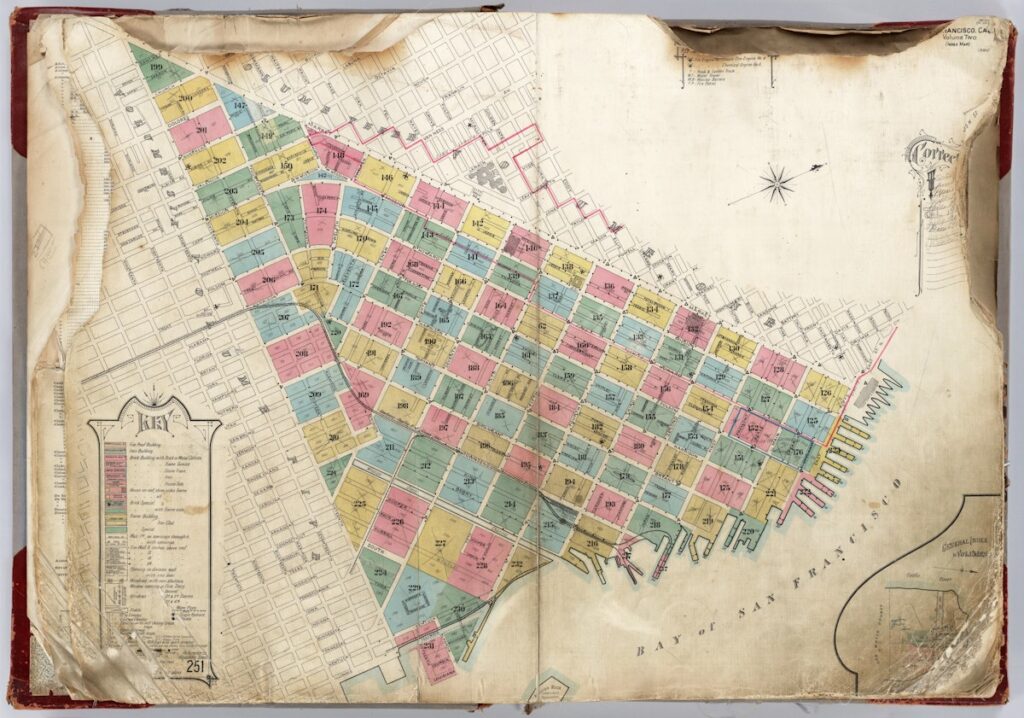
“These maps used an elaborate system of color coding, symbols, and abbreviations to indicate a dizzying amount of information — from building materials to street widths; from locations of standpipes to the presence of flammable chemicals; from the height of a structure to the number of skylights. Sanborn’s company didn’t provide any insurance itself — it supplied the insurance companies with the information, in the form of maps, they would need to assess risk and assign premiums.” Tobiah Black
Reminiscent of early enclosure maps, these drawings include information now being used for research into family histories – introducing unforeseen commercial layers as part of the billion dollar genealogy products and services market.
Underpinned by this commercial role, these maps become data subsets in a larger view of the social, economic and ecological history of place. Vanishing the deep sense of indigenous wisdom, earth history and cultural memory, this extraction of information from place includes remote definition and parameter-setting of place-based knowledge central to commercial interests.
===========================
re-layering local knowledge
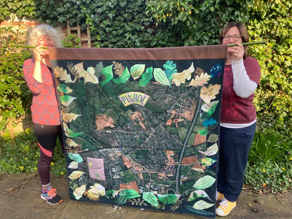
In 1985, Common Ground published Holding Your Ground: an action guide to conservation, marking the beginning of their influential and hugely inspirational Parish Maps.
“A Parish Map demonstrates what people claim as their own locality and what they value in it – wildlife, history, work, landmarks, buildings, people, festivals. It does not have to be precise or cartographically correct, but by illustrating locally distinctive activities and features, it helps you to focus on the everyday things that make your place significant to you and different from the next. It can include the elusive responses which cannot be measured or counted and also the invisible – the stories, dialect, names and fragments of everyone’s history”
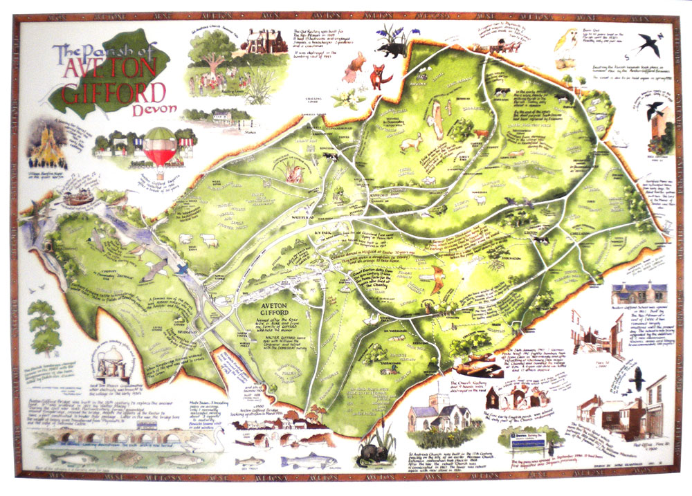
Thousands of maps across the UK have been inspired by Common Ground. Their archive is held as a special collection at University of Exeter > info here
Reclaiming memories within local storytelling traditions, adding creative agency to lived experience, embracing an iconoclastic approach to the deep structural power of historical administrative boundaries, Common Ground reconfigured the ecclesiastical sense of ‘parish’ to a new, collective definition of home place.