mapping the neighbourhood
A suburb on the north eastern edge of the city, the parish village of Pinhoe joined Exeter city in 1966. Following multiple major housing developments between 2011 and 2021, Pinhoe’s population increased by 50% to >9000 residents
BOUNDARIES > LIVED / ECONOMIC / NEIGHBOURS
Developing the idea of “Greater Pinhoe”
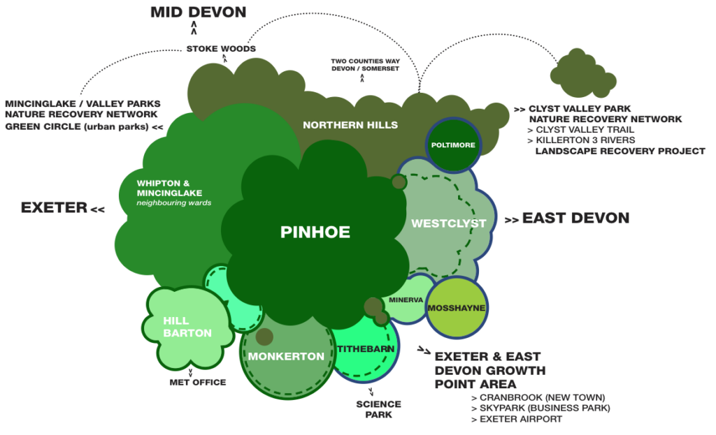
To understand the porous boundaries of Pinhoe as a growth point development area for both Exeter City and East Devon District councils, we mapped the community’s lived experience of place which crosses these political and representational borders. We also note the different County Council boundary which incorporate neighbouring wards in Exeter City but not Broadclyst Parish (East Devon). Devon County Council holds budgets and responsibility for Highways infrastructure.
STAGE ONE TIPPING POINTS IDENTIFIED / 2022
• GREEN INFRASTRUCTURE > NATURE RECOVERY NETWORK connecting the Clyst Valley Park and Trail with Exeter’s Valley Parks across the Northern Hills bordering Pinhoe / Landscape Recovery Scheme / ELMS government policy initiatives for landownership models
• TRANSPORT STRATEGY > UPDATED VISION: neighbourhood evidence to support new vision for growth point area, building from behaviour change
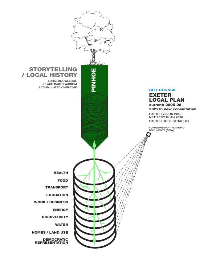
Place-based narratives leading policy understanding and discussion
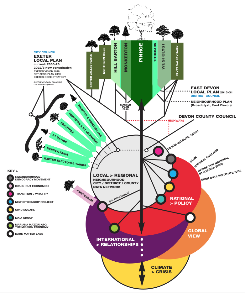
Policy and information network, connecting transformational models
Policy connections across neighbourhoods in Exeter: connecting local development to global climate impacts serves to connect new thinking at both national and international levels. Our drawing showed the following examples: Transition, Doughnut Economics, the Mission Economy, modelling by Dark Matter Labs.
NOTE:
• characteristics of place shown as tree species > using the ‘wood wide web’ network model